Map of Nile
Monday, 4 April 2011
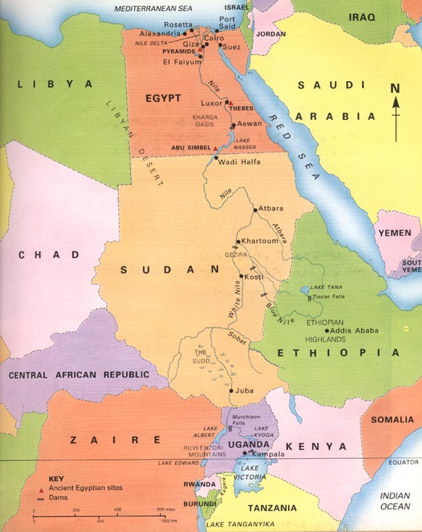
Nile River
The Nile is a major north-flowing in is a major north-flowing river in North Africa, generally regarded as the longest in the world. It is 6,650 km (4,130 miles) long.There are 2 major tributaries, the blue and white Nile.Nile means great river in Ancient Egyptian. It flows north through Rwanda, Tanzania, Lake Victoria, Uganda, Sudan. The Blue Nile starts at Lake Tana in Ethiopia and flows into Sudan from the southeast. They meet near the Sudanese capital of Khartoum.The northern section of the river flows through desert, from Sudan into Egypt, a country whose civilization has depended on the river since ancient times. Most of the population and cities of Egypt lie along the Nile, and nearly all the cultural and historical sites of Ancient Egypt are found along riverbanks. The Nile ends in a large delta that empties into the Mediterranean Sea.The furthest stream—and thus the source of the Nile—emerges from Bururi Province in Burundi, via the Ruvyironza and Kagera rivers, before flowing into Lake Victoria in Tanzania near the town of Bukoba.The Nile's water has affected the politics of East Africa and the Horn of Africa for many decades. Countries including Uganda, Sudan, Ethiopia and Kenya have complained about Egyptian domination of its water resources.
Subscribe to:
Posts (Atom)